Russian Soldier Caught in Ukrainian Territory by Instagram Geo-Tagging

So busted. Oh sooo busted.
Anyone doubt the truth now?
UPDATE-Okay apparently there can be a pretty rough location with Instagram depending on if the location was taken from a cell tower, or the guys phone had his GPS on and his Instagram set is a certain way. Perhaps this will become more clear later. Thanks to Klys and TimothyWatson for the correction.
From NY Post-the photo map
 Accurate?
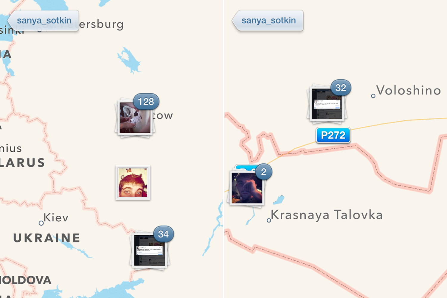
Image: 10475005_590989334352603_1411459963_n.jpg
The Instagram account of a Russian solider may have landed under-pressure Vladimir Putin in hot water after the app’s photomap placed 24-year-old Sanya Sotkin’s selfies in rebel-held Ukrainian territory.
The selfie-addicted solider’s Instagram may be vital in proving Russia’s involvement in the Ukrainian civil war after images show the active-duty Sotkin operating in the disputed territory.
This is despite Moscow denying any involvement in the conflict which saw Malaysian Airlines flight MH17 tragically shot down, killing 298 people on board.
One selfie posted on 5 July, shows Sotkin in rebel controlled territory near the town of Krasny Derkul.
More: Selfie-Addicted Russian Soldier Caught in Ukrainian Territory by Instagram Geo-Tagging


